About Natural Hot Springs in Idaho
Idaho has the most usable natural hot springs in the Nation, with about 130 soakable out of 340. Nevada has the most hot springs overall, but the majority of them are not soakable.
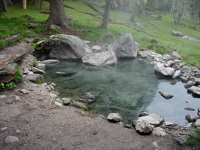
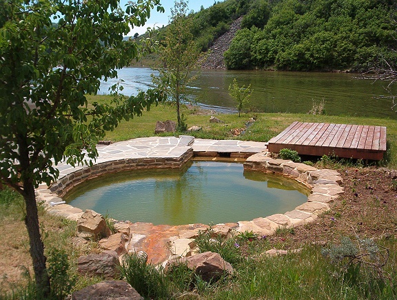
Geothermal water in Idaho is hot because it is heated from within the Earth's crust, forcing it up to the surface where pools are developed or form naturally near the outflow. Ninety percent of Idaho's 340 hot springs are the result of leftover energy heating water near fault lines whereas the remaining hot springs are traditionally heated by volcanic activity.
Select from the Regions Below to View Individual Idaho Hot Springs Listings
5 Regions of Hot Springs in Idaho:
 Region 1: North-Central Idaho
Nearby Cities: Grangeville, Lewiston, Lolo
Public Lands: Clearwater and Nez Pierce National Forests, Selway-Bitterroot Wilderness
 Region 2: West-Central Idaho
Nearby Cities: Cascade, Council, McCall, Riggins
Public Lands: Boise and Payette National Forests
 Region 3: East-Central Idaho
Nearby Cities: Challis, Idaho Falls, North Fork, Salmon
Public Lands: Salmon-Challis National Forest
 Region 4: South-Central Idaho
Nearby Cities: Boise, Fairfield, Garden Valley, Idaho City, Mountain Home, Stanely, Sun Valley, Twin Falls
Public Lands: Boise and Sawtooth National Forests, Sawtooth National Recreation Area (SNRA)
 Region 5:
South-East Idaho
Region 5:
South-East IdahoNearby Cities: American Falls, Downey, Lava Hot Springs, Pallisades, Preston
Idaho Hot Springs Region 1: North-Central Idaho
- Click on the linked hot springs names to view associated information like fees, access restrictions, pictures, directions and more.
- Cities: Grangeville, Lewiston, Lolo
- Season: SP = Spring, SM = Summer, ALL* = Snowmobile, skis or snowshoes required
- Type: R = Roadside, H = Hike, M = Multiday
Grangeville Area Hot Springs
- Marten Creek [SM] [FALL] (M)
- Running Creek [SM] [FALL] (H)
- Red River [ALL] - COMMERCIAL (RV park, vault toilets) (visit website)
- Stuart [SM] [FALL] (M)
Lewiston Area Hot Springs
- Jerry Johnson [ALL] (H)
- Prospector [SM] [FALL] (M)
- Stanley [SM] [FALL] (H) (M)
- Weir Creek [SM] [FALL] (H)
Idaho Hot Springs Region 2: West-Central Idaho
- Click on the linked hot springs names to view associated information like fees, access restrictions, pictures, directions and more.
- Cities: Cascade, Council, McCall, Riggins
- Season: SP = Spring, SM = Summer, ALL* = Snowmobile, skis or snowshoes required
- Type: R = Roadside, H = Hike, M = Multiday
Cambridge Area Hot Springs
- Oxbow [SM] [FALL] (H)
Cascade Area Hot Springs
- Bernard [ALL] (R)
Council Area Hot Springs
- Council Mountain (Laurel) [SM] [FALL] (H)
- White Licks [SP] [SM] [FALL] (R) - NO LONGER AVAILABLE, PRIVATE PROPERTY/CLOSED
McCall Area Hot Springs
- Burgdorf Hot Springs [ALL] (R) - COMMERCIAL
- Gold Fork [ALL] (R) - COMMERCIAL
- Krigbaum (Last Chance, Keep Out) [ALL] (H) - PRIVATE PROPERTY/CLOSED
- Secesh (Delta Mist, Whangdoodle) [SM] [FALL] (H) (M)
- Zims [ALL] - COMMERCIAL
Riggins Area Hot Springs
- Cable Car [SM] [FALL] (H)
- The Lodge at Riggins - COMMERCIAL (lodge, cabins, conference center)
Idaho Hot Springs Region 3: East-Central Idaho
- Click on the linked hot springs names to view associated information like fees, access restrictions, pictures, directions and more.
- Cities: Blackfoot, Challis, North Fork, Salmon
- Season: SP = Spring, SM = Summer, ALL* = Snowmobile, skis or snowshoes required
- Type: R = Roadside, H = Hike, M = Multiday
Blackfoot Area Hot Springs
- Blackfoot Reservoir
- Blackfoot Reservoir II
- Blackfoot River
Challis Area Hot Springs
- Barney WS [SM] [FALL] (R)
- Challis [ALL] - COMMERCIAL (visit website)
- Triple Creek/Foster Ranch #1 [SM] [FALL] (M)
- Unknown HS [SM] [FALL] (M)
- Lower Loon [SM] [FALL] (M)
- Shower Bath [SM] [FALL] (M)
- Warm Springs Creek (Sitz Bath) [SM] [FALL] (M)
Dubois Area Hot Springs
- Lidy - CLOSED
- Warm Springs Creek
Idaho Falls Area Hot Springs
- Green Canyon [ALL] - COMMERCIAL (campground, food, lodging, RV park) (visit website)
- Heise [ALL] - COMMERCIAL (campground, food, lodging, RV park) (visit website)
Middle Fork Salmon River - Frank Church River of No Return Wilderness
- Lost Creek [SM] [FALL] (M)
- Henry WS [SM] [FALL] (M)
- Hood Ranch [SM] [FALL] (M)
- Hospital Bar [SM] [FALL] (M)
- Middle Fork Indian Creek [SM] [FALL] (M)
- Mormon Ranch (Cold Springs Creek) [SM] [FALL] (M)
- Pistol Creek [SM] [FALL] (M)
- Sunflower Flats [SM] [FALL] (M)
- Thomas Creek Ranch [SM] [FALL] (M)
- Whitey Cox [SM] [FALL] (M)
North Fork Area Hot Springs
- Cronk's Canyon (Royal Gorge) [SM] [FALL] (R)
Salmon Area Hot Springs
- Goldbug [ALL] (H)
Shoup Area Hot Springs
- Barth [SM] [FALL] (M)
- Horse Creek [SM] [FALL] (R)
- Owl Creek [SM] [FALL] (H)
- Panther (Big Creek) [SM] [FALL] (R)
Tendoy Area Hot Springs
- Sharkey (Tendoy) [ALL] (R)
- Sharkey II (Lewis & Clark) [ALL] (R)
Idaho Hot Springs Region 4: South-Central Idaho
- Click on the linked hot springs names to view associated information like fees, access restrictions, pictures, directions and more.
- Cities: Boise, Fairfield, Lowman, Mountain Home, Sun Valley
- Season: SP = Spring, SM = Summer, ALL* = Snowmobile, skis or snowshoes required
- Type: R = Roadside, H = Hike, M = Multiday
Atlanta Area Hot Springs
- Atlanta [ALL*] (R)
- Browns Creek [SM] [FALL] (R)
- Chattanooga [SM] [FALL] (R)
- Dutch Frank (Roaring River) [SM] [FALL] (R)
- Goat Flats
- Granite Creek [SM] [FALL] (R)
- Greylock [SM] [FALL] (R)
- Loftus [ALL] (R)
- Lynx Creek [SM] [FALL] (H)
- Ninemeyer [SM] [FALL] (R)
- Pete Creek [SM] [FALL] (R)
- Phifer (Weatherby Mill) WS [ALL] (R)
- Sheep Creek Bridge [SM] [FALL] (R)
- Smith's Cabin [SM] [FALL] (R)
- Round the Bend [SM] [FALL] (R)
- Twin Springs Resort [SP] [SM] [FALL] (R) - COMMERCIAL
- Weatherby (Hot Creek) [SM] [FALL] (R)
- Unnamed ID HS #3 (HCS) [SM] [FALL] (H)
- Unnamed ID HS #4 [SM] [FALL] (R)
Banks Area Hot Springs
- Bronco Billy (Deer Creek) [ALL] (R)
- Skinnydipper (MM 4 / Deer #2) [ALL] (H)
Boise Area Hot Springs
Burley Area Hot Springs
- Marsh Gulley [SM] [FALL] (H)
Bruneau Area Hot Springs
- Balanced Rock
- Bruneau
- Indian Bathtub (gone)
- Indian Bathtub II (Lower Indian Bathtub, Bruneau) [SM] [FALL] (R)
Carey Area Hot Springs
- Wild Rose (Mildord Sweat) [ALL] (R)
Clayton Area Hot Springs
Crouch Area Hot Springs
- Bull Creek [SM] [FALL] (M)
- Bull Rack [SM] [FALL] (M)
- Boiling Springs [SP] [SM] [FALL] (H)
- Fire Crew (Holdover) [SM] [FALL] (R)
- Groundhog I (Horseshoe) [SM] [FALL] (H)(M)
- Groundhog II (Butterfly) [SM] [FALL] (H) (M)
- Moondipper (Dash #1) [SP] [SM] (H) (M)
- Pine Burl (Dash #2) [SP] [SM] [FALL] (H) (M)
- Rocky Canyon [SP] [SM] [FALL] (R)
- Silver Creek Plunge [SM] (R) - COMMERCIAL
Emmett Area Hot Springs
- Roystone [ALL] - COMMERCIAL
Featherville Area Hot Springs
- Baumgartner [SP] [SM] [FALL] (R)
- Elk Flats (bridge) [SM] [FALL] (R)
- Elk Flats (culvert) [SM] [FALL] (R)
- Lightfoot [SM] [FALL] (H)
- Paradise [ALL] (R) - COMMERCIAL
- Willow Creek [SM] [FALL] (H)
Fairfield Area Hot Springs
- Hot Springs Landing (Magic Valley) [ALL] (R)
- Preis [SP] [SM] [FALL] (H)
- Skillern [SP] [SM] [FALL] (H)
- Worswick [SP] [SM] [FALL] (R)
Garden Valley Area Hot Springs
- Brockman Creek
- Campground [ALL] (R)
- Little Anderson (Anderson) [ALL*] (H)
- Unnamed ID HS #1 (R)
Glenns Ferry Area Hot Springs
- Prince Albert [SM] [FALL] (H)
Grasmere Area Hot Springs
- Indian [SM] [FALL] (H)
Idaho City Area Hot Springs
- The Springs Resort [ALL] - COMMERCIAL
Ketchum Area Hot Springs
- Clarendon Hot Springs [?] (?) 7mi from Hailey
- Easley [June-Labor Day] - COMMERCIAL (98 degree hot tubs, 85 degree pool, campground, changing rooms) (visit website)
- Frenchman's Bend [SM] [FALL] (R)
- Guyer - Status Unknown
- Russian John WS [SM] (R)
- Warfield [SM] [FALL] (R)
Lowman Area Hot Springs
- Bonneville [ALL*] (H)
- Deadwood [SM] [FALL] (H)
- Haven [ALL] - COMMERCIAL (cafe, motel, restaurant) (visit website)
- Kirkham [ALL*] (R)
- Pine Flats [ALL*] (H)
- Sacajawea [SM] [FALL] (R)
- Sawtooth Lodge [SM] [FALL] - COMMERCIAL (lodge, cabins) (visit website)
- Tenmile [SM] [FALL] (H)
Melba Area Hot Springs
- Givens [ALL] - COMMERCIAL (campground, food, lodging, RV park) (visit website)
Stanley Area Hot Springs
- Basin Creek Campground [SM] [FALL] (R)
- Basin Creek (Cove/Kem) [SM] [FALL] (R)
- Bear Valley [SM] [FALL] (H) (M)
- Bonus [SM] [FALL] (R)
- Boundary Creek [SM] [FALL] (H)
- Dagger Creek [SM] [FALL] (H)
- Elkhorn (Boat Box) [ALL] (R)
- Idaho Rocky Mountain Ranch [SM] [FALL] - COMMERCIAL (9mi S of Stanley on HWY 75 between MM 180 and 181) (lodge rooms, cabins, retreats, events) (visit website)
- Mormon Bend [SM] [FALL] (R)
- Mountain Village Resort [ALL] - COMMERCIAL
- Sheepeater [SP] [SM] [FALL] (M)
- Sitting Bull [SP] [SM] [FALL] (H) (M)
- Snake Pit [SM] [FALL] (R)
- Trail Flat [SM] [FALL] (M)
Sunbeam Area Hot Springs
- Lunchbreak Warm Spring [SM] [FALL] (R)
- Owen Cabin [SM] [FALL] (H) (M)
- Slate Creek (Hoodoo) [ALL*] (H)
- Sunbeam [SM] [FALL] (R)
- Upper Loon (1-4) [SM] [FALL] (H) (M)
Twin Falls Area Hot Springs
- Banbury and Miracle [ALL] - COMMERCIAL
- Desert/Murphy - Status Unknown
- Durfee [ALL] - COMMERIAL (hot tub,
swimming pools) (visit
website)
Directions: From I-84 eastbound, take Rupert/Declo exit. Head south on 77. Travel through Declo, Albion, Elba. Head south to Durfee Hot Springs from Elba. - Magic - Status Unknown
- Nat-Soo-Pah [SM] - COMMERCIAL (campground, food, RV park) (visit website)
- Sliger's Thousand Springs Resort [ALL] - COMMERCIAL (campground, RV park) (visit website)
Idaho Hot Springs Region 5: South-East Idaho
- Click on the linked hot springs names to view associated information like fees, access restrictions, pictures, directions and more.
- Cities: American Falls, Downey, Lava Hot Springs, Palisades, Preston
- Season: SP = Spring, SM = Summer, ALL* = Snowmobile, skis or snowshoes required
- Type: R = Roadside, H = Hike, M = Multiday
American Falls
- Indian Springs Resort [ALL] - COMMERCIAL
Downey Area Hot Springs
- Downata [ALL] - COMMERCIAL
Lava Hot Springs Area Hot Springs
- Aura Soma Lava [ALL] - COMMERCIAL
- Home Hotel & Motel [ALL] - COMMERCIAL
- Lava Hot Springs (The main attraction!) [ALL] - COMMERCIAL
- Lava Hot Springs Inn & Spa [ALL] - COMMERCIAL
- Riverside Inn [ALL] - COMMERCIAL
Palisades Area Hot Springs
- Bear Creek [SM] [FALL] (M)
Preston Area Hot Springs
- Riverdale Resort [ALL] - COMMERCIAL
Saint Charles Area Hot Springs
- Bear Lake [All] - COMMERCIAL
Thatcher Area Hot Springs
- Maple Grove [ALL] - COMMERCIAL
Know of a hot springs not on the above list?